As a society, we use land in many different ways. The way …
As a society, we use land in many different ways. The way we use land has a tremendous impact on how water flows over and through land as it makes it way to streams, rivers, and the Great Lakes. When rainwater falls on land, it gradually makes its way downhill. In developed areas, including both farms and urban areas, there is much less vegetation to slow the water down. As a result, the water moves quickly over the surface of the ground, picking up dirt and other materials and carrying it along with the flow of water. This process is known as "erosion." The suspended material, called "sediment," is carried through the watershed to the streams, rivers, and lakes. Success with this lesson will happen when students are able to explore the land use around sample Michigan sites, and use that information to analyze which sites have the highest average sediment levels and which have the lowest.
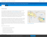
In this project, students evaluate areas in Gresham, Oregon, a city of …
In this project, students evaluate areas in Gresham, Oregon, a city of about 100,000 people located east of Portland. They look for suitably-zoned areas where young adults are known to live and where renting is common. Since many of the prospective tenants will commute to Portland, students also look for areas that afford easy access to the city's light-rail system. While these are not the only factors that determine a good site, they are important criteria that will help the company refine its search.
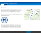
In this project, students will learn how to find the area that …
In this project, students will learn how to find the area that drains to a storm drain and the route that pollutants will take if they are dumped or washed into the drain. They will find the upstream drainage area, called a watershed, for a storm drain near Blackman Elementary School in Tennessee. Then they find the downstream flow path to where it empties into the Gulf of Mexico. Knowing how to find these, students can experiment to find the watersheds and flow paths from other storm drain locations.
Explore urban areas around the world, including their layout, size, and other …
Explore urban areas around the world, including their layout, size, and other factors.
GeoInquiries are designed to be fast and easy-to-use instructional resources that incorporate advanced web mapping technology. Each 15-minute activity in a collection is intended to be presented by the instructor from a single computer/projector classroom arrangement. No installation, fees, or logins are necessary to use these materials and software.
Students will analyze how the market areas for specific chain stores change …
Students will analyze how the market areas for specific chain stores change based on the type of store.
GeoInquiries are designed to be fast and easy-to-use instructional resources that incorporate advanced web mapping technology. Each 15-minute activity in a collection is intended to be presented by the instructor from a single computer/projector classroom arrangement. No installation, fees, or logins are necessary to use these materials and software.
Students will explore the spatial patterns of the Human Development Index (HDI) …
Students will explore the spatial patterns of the Human Development Index (HDI) to identify regional patterns and causal factors in the data.
GeoInquiries are designed to be fast and easy-to-use instructional resources that incorporate advanced web mapping technology. Each 15-minute activity in a collection is intended to be presented by the instructor from a single computer/projector classroom arrangement. No installation, fees, or logins are necessary to use these materials and software.
Students will explore patterns of cultural diffusion through linguistic and religious data. …
Students will explore patterns of cultural diffusion through linguistic and religious data.
GeoInquiries are designed to be fast and easy-to-use instructional resources that incorporate advanced web mapping technology. Each 15-minute activity in a collection is intended to be presented by the instructor from a single computer/projector classroom arrangement. No installation, fees, or logins are necessary to use these materials and software.
This activity examines species richness to gain insight to evolutionary selection factors …
This activity examines species richness to gain insight to evolutionary selection factors that encourage greater diversity.
GeoInquiries are designed to be fast and easy-to-use instructional resources that incorporate advanced web mapping technology. Each 15-minute activity in a collection is intended to be presented by the instructor from a single computer/projector classroom arrangement. No installation, fees, or logins are necessary to use these materials and software.
This activity explores potential and developed wind capacity by state as well …
This activity explores potential and developed wind capacity by state as well as challenges that Texas has faced to develop wind power.
GeoInquiries are designed to be fast and easy-to-use instructional resources that incorporate advanced web mapping technology. Each 15-minute activity in a collection is intended to be presented by the instructor from a single computer/projector classroom arrangement. No installation, fees, or logins are necessary to use these materials and software.
This activity explores patterns and characteristics of El Niño and effects on …
This activity explores patterns and characteristics of El Niño and effects on global climate.
GeoInquiries are designed to be fast and easy-to-use instructional resources that incorporate advanced web mapping technology. Each 15-minute activity in a collection is intended to be presented by the instructor from a single computer/projector classroom arrangement. No installation, fees, or logins are necessary to use these materials and software.
This activity explores deforestation trends and patterns. GeoInquiries are designed to be …
This activity explores deforestation trends and patterns.
GeoInquiries are designed to be fast and easy-to-use instructional resources that incorporate advanced web mapping technology. Each 15-minute activity in a collection is intended to be presented by the instructor from a single computer/projector classroom arrangement. No installation, fees, or logins are necessary to use these materials and software.
This actity explores abiotic factors associated with primary productivity. GeoInquiries are designed …
This actity explores abiotic factors associated with primary productivity.
GeoInquiries are designed to be fast and easy-to-use instructional resources that incorporate advanced web mapping technology. Each 15-minute activity in a collection is intended to be presented by the instructor from a single computer/projector classroom arrangement. No installation, fees, or logins are necessary to use these materials and software.
Explore the impact of human activities on water resources. GeoInquiries are designed …
Explore the impact of human activities on water resources.
GeoInquiries are designed to be fast and easy-to-use instructional resources that incorporate advanced web mapping technology. Each 15-minute activity in a collection is intended to be presented by the instructor from a single computer/projector classroom arrangement. No installation, fees, or logins are necessary to use these materials and software.
As the United States acquired land and new states formed, the balance …
As the United States acquired land and new states formed, the balance of power between the free and slave states needed to be addressed.
GeoInquiries are designed to be fast and easy-to-use instructional resources that incorporate advanced web mapping technology. Each 15-minute activity in a collection is intended to be presented by the instructor from a single computer/projector classroom arrangement. No installation, fees, or logins are necessary to use these materials and software.
Explore relationships between temperature, pressure, and humidity with daily weather forecasts. GeoInquiries …
Explore relationships between temperature, pressure, and humidity with daily weather forecasts.
GeoInquiries are designed to be fast and easy-to-use instructional resources that incorporate advanced web mapping technology. Each 15-minute activity in a collection is intended to be presented by the instructor from a single computer/projector classroom arrangement. No installation, fees, or logins are necessary to use these materials and software.
Introduce and explore various types of landforms. GeoInquiries are designed to be …
Introduce and explore various types of landforms.
GeoInquiries are designed to be fast and easy-to-use instructional resources that incorporate advanced web mapping technology. Each 15-minute activity in a collection is intended to be presented by the instructor from a single computer/projector classroom arrangement. No installation, fees, or logins are necessary to use these materials and software.
Examine patterns of where rock types form and the relationship they have …
Examine patterns of where rock types form and the relationship they have toward each other
GeoInquiries are designed to be fast and easy-to-use instructional resources that incorporate advanced web mapping technology. Each 15-minute activity in a collection is intended to be presented by the instructor from a single computer/projector classroom arrangement. No installation, fees, or logins are necessary to use these materials and software.
Analyze the quantities and origins of basic mineral resources. GeoInquiries are designed …
Analyze the quantities and origins of basic mineral resources.
GeoInquiries are designed to be fast and easy-to-use instructional resources that incorporate advanced web mapping technology. Each 15-minute activity in a collection is intended to be presented by the instructor from a single computer/projector classroom arrangement. No installation, fees, or logins are necessary to use these materials and software.
In this activity, students interpret the landscape using topographic maps of well-known …
In this activity, students interpret the landscape using topographic maps of well-known national parks.
GeoInquiries are designed to be fast and easy-to-use instructional resources that incorporate advanced web mapping technology. Each 15-minute activity in a collection is intended to be presented by the instructor from a single computer/projector classroom arrangement. No installation, fees, or logins are necessary to use these materials and software.
No restrictions on your remixing, redistributing, or making derivative works. Give credit to the author, as required.
Your remixing, redistributing, or making derivatives works comes with some restrictions, including how it is shared.
Your redistributing comes with some restrictions. Do not remix or make derivative works.
Most restrictive license type. Prohibits most uses, sharing, and any changes.
Copyrighted materials, available under Fair Use and the TEACH Act for US-based educators, or other custom arrangements. Go to the resource provider to see their individual restrictions.