Conditional Remix & Share Permitted
CC BY-NC-SA
Kindergarten Eureka Math
- Subject:
- Mathematics
- Material Type:
- Activity/Lab
- Assessment
- Author:
- Liberty Public Schools
- Date Added:
- 06/10/2021
Kindergarten Eureka Math

In this unit, students will understand where “fake news” comes from, why it exists and how they can think like fact checkers to become fluent consumers, evaluators, and creators of information. They will apply this knowledge by selecting a controversial topic to evaluate, synthesize, and analyze all aspects before sharing with a local audience.

This short video and interactive assessment activity is designed to give fourth graders an overview of 24-hour clocks.

This short video and interactive assessment activity is designed to give fifth graders an overview of 24-hour clocks.

This short video and interactive assessment activity is designed to give fourth graders an overview of 24-hour clocks.

This lesson unit is intended to help teachers assess how well students are able to visualize two-dimensional cross-sections of representations of three-dimensional objects. In particular, the lesson will help you identify and help students who have difficulties recognizing and drawing two-dimensional cross-sections at different points along a plane of a representation of a three-dimensional object.

This task provides Grade 3 students with modeling practice.

This is a flawed reasoning task using content from 2.NBT.5 and 2.NBT.6.

This is a flawed reasoning task using content from 2.NBT.5 and 2.NBT.6.

This resource houses links to a variety of sample math tasks aligned to the Common Core standard. Sources may include but are not limited to: Illustrative Mathematics, PARCC, Khan Academy, and the Illinois State Board of Education.

This resource houses links to a variety of sample math tasks aligned to the Common Core standard. Sources may include but are not limited to: Illustrative Mathematics, PARCC, Khan Academy, and the Illinois State Board of Education.

This resource houses links to a variety of sample math tasks aligned to the Common Core standard. Sources may include but are not limited to: Illustrative Mathematics, PARCC, Khan Academy, and the Illinois State Board of Education.

This task has students solve a multi-step addition and subtraction problem based on a given data chart. Students are solving a variety of problem types involving addition and subtraction. This task is related to evidence statement 3.D.2 and Common Core Standard 2.OA.A.1

Challenge for students expressing two digit numbers using knowledge of place value.
In this unit, 2nd grade students explore different habitats (forest, desert, water, and rainforest) and investigate how different plants and animals survive in each habitat. Rather than just learning facts about the habitats, students examine the connection between parts of each habitat and how those connections are crucial for survival. Using the Next Generation Science Standards as a guide, students are challenged to use the information they learn about different habitats to compare how different plants and animals depend on their surroundings and other living things to meet their needs. Students will also be challenged to compare the differences in the kinds of living things that are found in different areas and why those differences exist. This unit builds on the 1st grade Animals unit, in which students learned about different types of animals and their characteristics, and prepares students for a 3rd grade unit in which they will analyze animal adaptations with regard to animal habitats. This unit uses the Bobbie Kalman Introducing Habitats series as mentor texts. These texts were chosen because of their clear representations of the different habitats and their accessibility. The texts in this unit support student understanding of key genre features while also allowing multiple opportunities to develop fluency. Over the course of the unit, the majority of heavy thinking and analysis should be on students. By the end of the unit, students should have a deeper understanding of key components of informational texts, and students should be able to transfer those understandings to other complex informational texts. Students will also write daily in response to the text, with a focus on using complete sentences and recognizing run-on sentences. Students will also begin writing longer informational texts in which they synthesize and teach back the content they are learning about the different habitats.
2nd Grade Eureka Math
A remix of Michigan social studies resources all in one place. In this foundational lesson students are introduced to the ways geographers look at places and the questions they ask. Students begin by reviewing the concept of ‘community’ and the geography of their local community by completing a class chart.
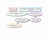
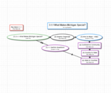
The Roadmap is a remix of Michigan resources all in one place. Students review relative and absolute (street address) location. They then use a Michigan map and cardinal directions to describe the relative location of their local community. Using a map of the United States and cardinal directions, students identify a variety of ways to describe the relative location of Michigan. The lesson concludes with a brief discussion of how location influences the development of a state. This lesson serves as the launching point for subsequent lessons in both history and economics.
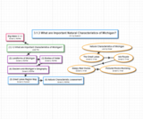
After reviewing natural (physical) and human characteristics from Lesson 1, students use maps to identify and describe significant natural (physical) characteristics of Michigan including mountain ranges, sand dune areas, the Great Lakes, inland lakes and important rivers. In a connection to science students briefly explore how glaciers helped to create some of these natural (physical) characteristics. The lesson uses multiple resources including informational text, legends and photographs.
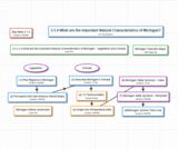
In this lesson students continue their study of the important natural (physical) characteristics of Michigan by exploring vegetation and climate. They begin by analyzing special purpose maps of forests and orchards. Next they are introduced to the concept of climate, connecting to science topics of weather and seasons from previous grades. In addition, they briefly explore the impact of the Great Lakes on climate. The lesson also includes a chart reading activity dealing with Michigan state symbols.