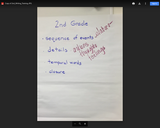
2nd Grade Writing Training Anchor Chart CKLA
- Subject:
- English Language Arts
- Material Type:
- Diagram/Illustration
- Date Added:
- 08/10/2020

2nd Grade Writing Training Anchor Chart CKLA
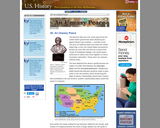
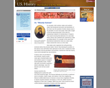
The Mexican War was over. Every goal set by the United States government when declaring war against Mexico was reached and then some. The ports of California were now under the United States flag. In fact, the United States increased its territory by more than one third as a result of the Treaty of Guadalupe-Hidalgo. One would expect Americans to rejoice and come together in a burst of postwar nationalism. These were not, however, ordinary times.
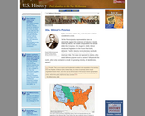
By the standards of his day, David Wilmot could be considered a racist. Yet the Pennsylvania representative was so adamantly against the extension of slavery to lands ceded by Mexico, he made a proposition that would divide the Congress. On August 8, 1846, Wilmot introduced legislation in the House that boldly declared, "neither slavery nor involuntary servitude shall ever exist" in lands won in the Mexican-American War. If he was not opposed to slavery, why would Wilmot propose such an action? Why would the north, which only contained a small, but growing minority, of abolitionists, agree?
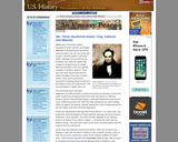
Henry Clay of Kentucky, John C. Calhoun of South Carolina, and Daniel Webster of Massachusetts dominated national politics from the end of the War of 1812 until their deaths in the early 1850s. Although none would ever be President, the collective impact they created in Congress was far greater than any President of the era, with the exception of Andrew Jackson. There was one issue that loomed over the nation throughout their time in power slavery. They were continuously successful in keeping peace in America by forging a series of compromises. The next generation's leaders were not.
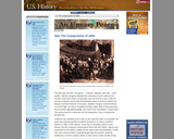
California was admitted to the Union as the 16th free state. In exchange, the south was guaranteed that no federal restrictions on slavery would be placed on Utah or New Mexico. Texas lost its boundary claims in New Mexico, but the Congress compensated Texas with $10 million. Slavery was maintained in the nation's capital, but the slave trade was prohibited. Finally, and most controversially, a Fugitive Slave Law was passed, requiring northerners to return runaway slaves to their owners under penalty of law.
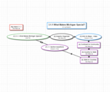
A remix of Michigan social studies resources all in one place. In this foundational lesson students are introduced to the ways geographers look at places and the questions they ask. Students begin by reviewing the concept of ‘community’ and the geography of their local community by completing a class chart.
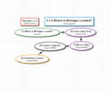
The Roadmap is a remix of Michigan resources all in one place. Students review relative and absolute (street address) location. They then use a Michigan map and cardinal directions to describe the relative location of their local community. Using a map of the United States and cardinal directions, students identify a variety of ways to describe the relative location of Michigan. The lesson concludes with a brief discussion of how location influences the development of a state. This lesson serves as the launching point for subsequent lessons in both history and economics.
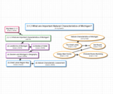
After reviewing natural (physical) and human characteristics from Lesson 1, students use maps to identify and describe significant natural (physical) characteristics of Michigan including mountain ranges, sand dune areas, the Great Lakes, inland lakes and important rivers. In a connection to science students briefly explore how glaciers helped to create some of these natural (physical) characteristics. The lesson uses multiple resources including informational text, legends and photographs.
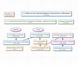
In this lesson students continue their study of the important natural (physical) characteristics of Michigan by exploring vegetation and climate. They begin by analyzing special purpose maps of forests and orchards. Next they are introduced to the concept of climate, connecting to science topics of weather and seasons from previous grades. In addition, they briefly explore the impact of the Great Lakes on climate. The lesson also includes a chart reading activity dealing with Michigan state symbols.
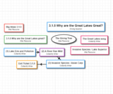
Important bodies of water include the Great Lakes, inland lakes, rivers and waterfalls. In a connection to science students briefly explore how glaciers helped to create some of these natural (physical) characteristics. The lesson uses multiple resources including informational text, legends and photographs.
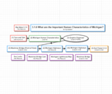
The Roadmap is a remix of the Michigan Open Book, MC3 and GIANTS all in one place. In this lesson students continue their study of the geographic theme of ‘place’ by exploring significant human characteristics of Michigan including bridges, cities, highways and lighthouses. In addition, students explore how people interact with natural (physical) characteristics by creating human characteristics (e.g. bridges are built over rivers, towns are built along bays.)
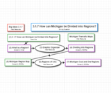
The Roadmap is a remix of the Michigan Open Book, MC3 and GIANTS all in one place. This lesson expands upon the concept of region by having students invent ways to divide Michigan into regions. Students compare the Lower Peninsula and Upper Peninsula of Michigan and then explore other ways in which Michigan can be divided into regions based on common characteristics (e.g., the Thumb, the Fruit Belt). Finally students examine regions to which Michigan belongs. (e.g., Great Lakes Region, Midwest).
Kansas would be the battleground on which the north and south would first fight. The Kansas-Nebraska Act led both to statehood and to corruption, hatred, anger, and violence. Men from neighboring Missouri stuffed ballot boxes in Kansas to ensure that a legislature friendly to slavery would be elected. Anti-slavery, or free soil, settlers formed a legislature of their own in Topeka. Within two years, there would be armed conflict between proponents of slavery and those against it.

Slideshow on Types of Deviance
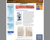
The Kansas-Nebraska Act of 1854 may have been the single most significant event leading to the Civil War. By the early 1850s settlers and entrepreneurs wanted to move into the area now known as Nebraska. However, until the area was organized as a territory, settlers would not move there because they could not legally hold a claim on the land. The southern states' representatives in Congress were in no hurry to permit a Nebraska territory because the land lay north of the 36°30' parallel where slavery had been outlawed by the Missouri Compromise of 1820. Just when things between the north and south were in an uneasy balance, Kansas and Nebraska opened fresh wounds.
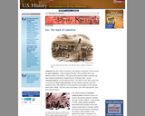
Lawrence was the center of Kansas's anti-slavery movement. It was named for Amos Lawrence, a New England financier who provided aid to anti-slavery farmers and settlers. This group went beyond simple monetary aid. New England Abolitionists shipped boxes of Sharps rifles, named "Beecher's Bibles," to anti-slavery forces. The name for the rifles came from a comment by Henry Ward Beecher, the anti-slavery preacher who had remarked that a rifle might be a more powerful moral agent on the Kansas plains than a Bible. The lines were now drawn. Each side had passion, and each side had guns.
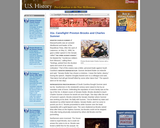
This describes the incident in which two Representative Preston Brooks of South Carolina beat Charles Sumner with a Cane over a debate about slavery. The incident polarized the country and was an antecedent to the Civil War

This tool is used for teachers to understand what the students are getting out of their learning by recording three things they learned, two questions and one main idea.

This tool is used for teachers to understand what the students are getting out of their learning by recording three things they learned, two questions and one main idea.
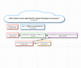
This Roadmap is a remix of Michigan Open Book, MC3 and GIANTS put together all in one place. In this lesson students connect geography to economics as they explore how natural resources are used to produce goods and services in Michigan. They use specific examples such as the use of fertile soil to grow major crops. Students then use a Michigan product to dissect the resources necessary for production. In exploring Michigan products, the concept of entrepreneurship is introduced.